Kathleen and I were excited to embark on a three-day, 986 mile road trip through south central Utah. We wanted to get better acquainted with our newly adopted state.
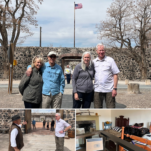
We were joined by our good friends, Jonn and Judy Claybaugh. Jonn and I have known each other since high school in California. Our first stop was to see Cove Fort, two hours south of home. The fort was built in 1867 at the request of Brigham Young as a secure way-station for travelers through central Utah. Today, it is owned by The Church of Jesus Christ of Latter-day Saints.
Senior missionaries conduct tours of this lava rock-constructed fort, the last totally original fort still in existence in the American west. Why lava rock?--timber was and still is in short supply in this region; and, it is situated not far from an ancient volcano.
Cedar Breaks National Monument, east of Cedar City, has an elevation of over 10,000 feet where we are standing, with a depth of over 2,000 feet. It was cold!
Heading south, we stopped in Orderville. The town was established in 1875 for Latter-day Saints to live and share freely with each other under the United Order. The Order lasted about ten years. Judy chats with the Daughters of the Utah Pioneers Museum docent, who she discovered is a distant relative of hers!
Cemeteries in Utah always include a mix of recent residents with original settlers. This headstone in Orderville is of Mary Benton (1810-1884). These resting places are testaments to the faith and tenacity of a people who fled religious persecution to forge new communities where none existed.
Moqui Cave is a unique museum of ancient history located north of Kanab. Built inside a huge cave along Highway 89, it houses a gift shop, rock collections, and ancient archeology finds. It's a must stop!
Judy points to a photo of her and Jonn's son who married into the family that owns and operates the cave.Across the highway from Moqui Cave, in the canyon, are additional caves. These are being developed by the same family into resort venues. A tree was carved by someone years ago with a chain-saw and was just recently discovered when the heavy brush was removed.
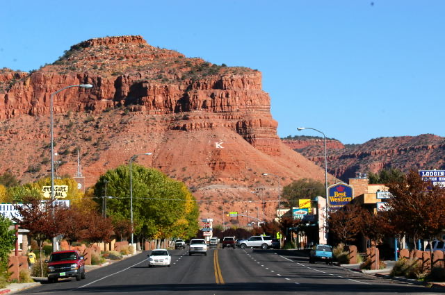
Kanab was settled near the Arizona state line. It was a popular destination for Western movie makers decades ago, as well as now, due to its stunning landscape and vistas.
We passed through Hatch, population 133, about fifty miles north of Kanab.
The houses of worship in rural Utah may differ in building materials. But, whether they are from the 19th century in Kanab (top), or of modern style in Hatch (bottom), the congregants’ strong faith in Jesus Christ remains the same no matter the time period. Bryce Canyon National Park is one of the most popular of the national parks due to its unparalleled beauty and grandeur. Here is the largest concentration of irregular columns of rock found anywhere on Earth—its geological wonders defy description. Located at around 8,000 feet, it was cold when we arrived.
Starting at Sunrise Point, we descended the Queens Garden Trail that connected with the Navajo Loop Trail.
Jonn pauses at the bottom prior to our ascent to Sunset Point.
Bryce Canyon is a favorite of international visitors. Judy made friends with a tourist from Germany, while Kathleen met a Scottish traveler with whom she shares ancestry. Kathleen was disappointed in my choice of a Bed and Breakfast in Escalante. (just kidding)
Overlooking Grand Staircase-Escalante National Monument in the distance.
Four miles west of Torrey, we begin hiking up to Hickman Bridge, along the Fremont River. We are now in Capitol Reef National Park.
The climb is steep up to the 133-foot natural stone bridge.
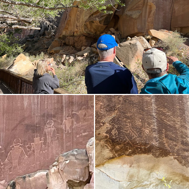
In the distance is one of the the white domes of Navajo sandstone that resembles the dome of the Capitol building in Washington, DC—the origin of the name of this national park.Near the trailhead to Hickman Bridge, we view the petroglyphs carved in the rock by the pre-historic inhabitants of this area.
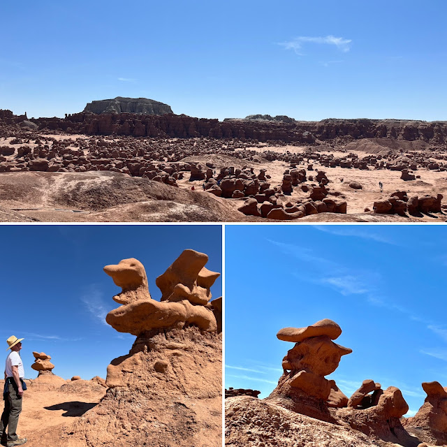
Goblin Valley State Park is a strange and mysterious valley, unlike any other in Utah, featuring thousands of hoodoos, referred to locally as goblins. The formations of mushroom-shaped rock pinnacles are the result of gradual erosion of sandstone, deposited 170 million years ago when the area was next to an ancient sea. Wandering through the goblins, I imagined myself on the set of the 1965 television show “Lost in Space”.
One goblin resembles a duck; the other a French artist wearing a beret.
Our last hike was up Little Wild Horse Canyon, five miles from Goblin Valley.
This is a slot canyon that is so narrow in some sections that only one hiker can pass between the sheer walls of stone.
Returning home via the I-70, we stopped to enjoy the panorama of the San Rafael Swell at the foot of Ghost Rock. The fastness of the valleys and canyons below once were hiding places for outlaws, including Butch Cassidy.

The temple in Manti was completed by local members of The Church of Jesus Christ of Latter-day Saints in 1888. It dominates the Sanpete Valley, and can be seen from many miles. Near this spot in 1977, as college students, we attended an outdoor temple pageant. Of course, being with Kathleen I didn’t watch much of the pageant— we were engaged two months later.

Northeast of Manti is Spring City. Although it is still largely a farming town, Spring City is becoming increasingly known for its many examples of 19th century pioneer architecture. The 1899 old schoolhouse is an example. In 2010, Forbes magazine identified Spring City as one of the prettiest towns in America.


